

Mt. Kilimanjaro Africa
Introduction:
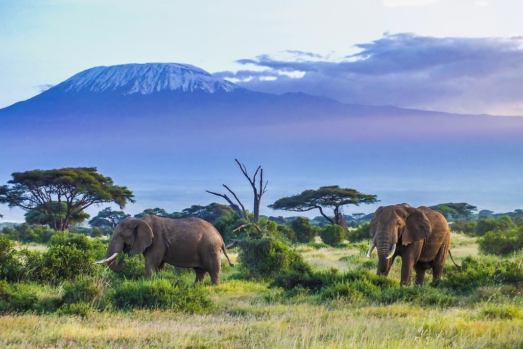
We’ve all heard about the famous Mt. Kilimanjaro and seen pictures of it in our textbooks and seen documentaries on TV. The world’s tallest free-standing mountain is the fourth of the Seven Summits. Uhuru Peak, Mount Kilimanjaro’s highest point, is located on the edge of its largest crater. The elevation of the peak, 5,895 meters above sea level, is indicated on the Uhuru Peak sign that marks the location. It is 19,431 feet high. Kilimanjaro is the highest approachable mountain in the world and the least technical, more of a multi-day, hard walk than a climb.
Up until 1952, Kilimanjaro’s Uhuru Peak was officially 5,892 meters high. German cartographers during the colonial era had placed that figure on the mountain. Having said that, it is important to note that Kilimanjaro is purportedly 5,893 meters tall per the United Nations Environment Programme.


The Altitudes Of The Cones:
The shape of Mount Kilimanjaro is not a tidy triangle pyramid. Instead, the mountain is composed of three dispersed volcanic cones:
- The highest cone, Kibo, is 5,895 meters (19,431 feet) above sea level and the one you will summit.
- The second-highest cone, Mawenzi, is 5,149 meters (16,893 ft) above sea level.
- The lowest cone, Shira, is 4,005 meters (13,140 feet) high.
The Prominence Of Mt. Kilimanjaro:
The height of a mountain that has no higher mountain in the vicinity and is surrounded by the lowest contour line is known as its topographic prominence.
Kilimanjaro is roughly 4,900 meters (16,100 feet) in prominence. This indicates that Kilimanjaro rises to a height of 4,900 meters from its plateau base, with its base situated approximately 1,000 meters above sea level. Kilimanjaro is located far from the coast of the Indian Ocean. That its prominence is not its full altitude is therefore not surprising.
The table below represents the mountain’s topographic prominence:
| Route Name | Prominence (In Kilometers) | Distance (In Kilometers) | Elevation Gain (In Meters) |
| Machame | 4,650 | 49.5 | 4,040 |
| Northern Circuit | 4,420 | 83.1 | 4,380 |
| Lemosho | 4,075 | 55.8 | 3,975 |
| Marangu | 3,950 | 64.4 | 3,840 |
| Rongai | 2,490 | 42.2 | 2,870 |


The Gain In Altitude
Although Kilimanjaro is 5,895 meters above sea level, you do not scale that height because you do not start your ascent from sea level. Kilimanjaro’s prominence is approximately 4,900 meters, as was previously stated. However, none of the seven Kilimanjaro paths begin at the mountain’s foot. Rather, they all begin within or immediately above the mountain’s forest band, which is located between 1,800 and 3,000 meters above sea level.
Mount Kilimanjaro’s ascent is a slow procedure that usually takes five to nine days. Depending on the route taken, the altitude increase on a climb of Mount Kilimanjaro might vary, but it often falls between 3,800 and 4,000 meters (9,800–13,100 feet).
The table below shows all the different trailheads of the mountain:
| Name Of The Route | Altitude | Starting Point |
| Shira Route | 3,414 meters; 11,200 feet | Morum Barrier |
| Lemosho Route | 2,100 meters; 6,890 feet | Lemosho Gate |
| Northern Circuit Route | 2,100 meters; 6,890 feet | Lemosho Gate |
| Rongai Route | 1,950 meters; 6,398 feet | Rongai Gate |
| Marangu Route | 1,843 meters; 6,047 feet | Marangu Gate |
| Umbwe Route | 1,800 meters; 5,906 feet | Umbwe Gate |
| Machame Route | 1,640 meters, 5,380 feet | Machame Gate |
The Machame route has the lowest starting altitude, whereas the Shira route has the highest starting altitude.
The altitude shifts for the most popular Mt. Kilimanjaro climbing routes are represented in the table the follows:
| Route Name | Gain In Altitude | Days Taken |
| Machame | 4,000 meters; 13,100 feet | 6-7 |
| Lemosho | 3,800 meters; 12,500 feet | 7-8 |
| Northern Circuit | 3,700 meters; 12,100 feet | 8-9 |
| Rongai | 3,400 meters; 11,200 feet | 6-7 |
| Marangu | 3,000 meters; 9,800 feet | 5-6 |
Mount Kilimanjaro Map
There are seven ways to get to Uhuru Peak, the peak. When hiking via the Rongai Route or Marangu Route, there are two routes for descent: the Mweka Route and the Marangu Route. The percentage of climbers that use the routes are:
| Route | Percentage Of Climbers Who Use Them |
| Machame Route | 41% |
| Marangu Route | 40% |
| Lemosho Route | 12% |
| Rongai Route | 6% |
| Northern Circuit Route | 1% |
| Shira Route | 0% |
| Umbwe | 0% |
Map of the mountain is on the right


Elevation VS Ascent
Ascent and elevation (or height difference) are not the same. The entire vertical distance covered by each upward step you take when climbing is known as the ascent. Ascending a mountain will involve more climbing than elevation gain due to the natural undulation of the paths. For example, you can go for several days via the Lemosho and Machame routes before arriving at Barranco Camp, which is 600 meters below Lava Tower. This implies that you will be “reclimbing” those 600 meters the next day. But most of the drops throughout the other routes are not nearly as sharp as this one.
The length, ascent, height gain, and summit time for each of the five primary routes up Mount Kilimanjaro are examined below:
| Route | Distance (Kilometers) | Ascent (Meters) | Elevation Gain (Meters) | Time To Summit (Days) |
| Marangu | 64.6 | 3,840 | 2,785 | 5-6 |
| Machame | 49.6 | 4,040 | 3,310 | 6-7 |
| Lemosho | 56.0 | 4,050 | 3,585 | 7-8 |
| Rongai | 65.2 | 2,870 | 1,995 | 6-7 |
| Northern Circuit | 98.6 | 4,380 | 4,035 | 8-9 |

The Best Time To Climb Mt. Kilimanjaro:
While it is technically feasible to walk Mount Kilimanjaro in Tanzania throughout the year, there are specific months that are known for having lower temperatures, heavier precipitation, and maybe a lot of snow on the summit.
Generally speaking, we recommend that the warmest and driest months of the year—December to mid-March and mid-June to the end of October—are the ideal seasons to climb Kilimanjaro.
But while the weather is said to be ideal for mountain climbing during these months, they are also the busiest.
To help you choose the ideal time to go on this mountain adventure, we have broken down the Kilimanjaro climbing season, off-peak options, and times to avoid, along with other important considerations.
Climbing In January And February
The best months to climb Mount Kilimanjaro are January and February. Since these are the hottest months, you can anticipate bright, sunny skies in the mornings and nights. In the afternoons, though, clouds may roll in and it might rain.
Climbing In March, April, And May
Beginning at the end of March and lasting until the beginning of June is the extended wet season. Kilimanjaro climbing is not advised at this time of year due to the possibility of extremely muddy, snowy, and rainy trails.
You won’t get the amazing views and photo opportunities if you climb in the rain, and it will probably be less fun. However, if you do decide to trek during this time of year, you’ll be able to escape the crowds at the campgrounds and on the trails (even the most well-traveled routes can provide seclusion, serenity, and tranquility).
Additionally, some individuals love the thought of ascending Kilimanjaro with the likelihood of snowfall on the top, since this can bring a new level of difficulty to your mountain trekking experience in addition to stunning scenery.
Climbing In June
June is typically far drier than March, April, and May since it marks the change from the wet to the dry season. But, you won’t always have such breathtaking vistas because the skies are usually still overcast and you should be ready for frigid weather.

Conclusion:
So now you know about the most popular starting points for starting your trek to Mt. Kilimanjaro, as well as the best time for climbing the same. We recommend contacting a guide licensed by the Kilimanjaro National Park. If you are not a regular hiker, though, we request you increase the amount of time you can spend on your feet each day and your walking endurance. Hiking day trips with a small elevation rise is the best method to get fit. You can train on stairs or a stair machine if trails aren’t accessible.
